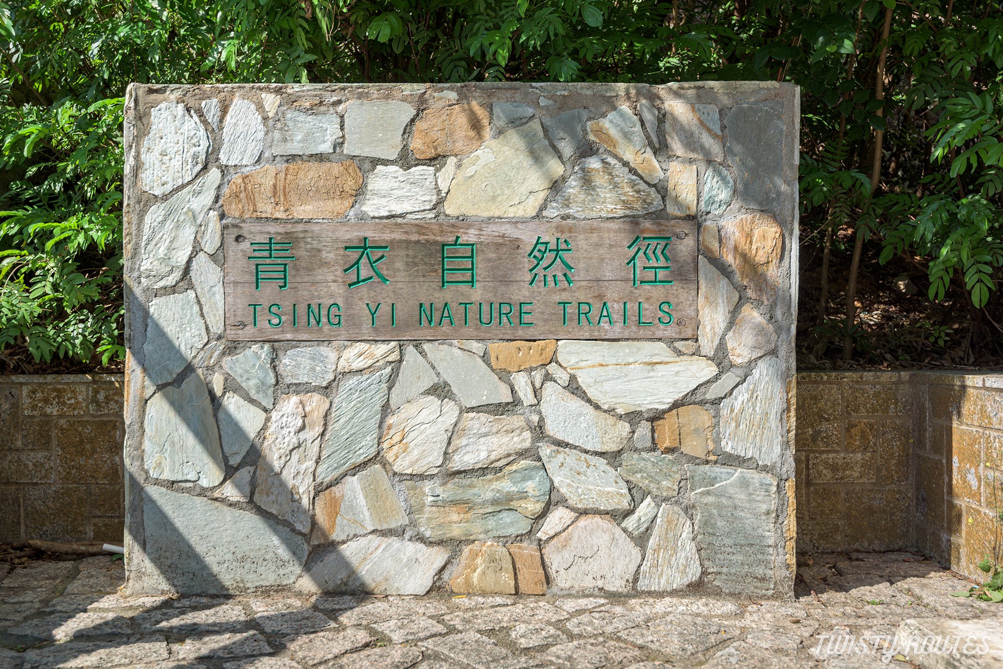
Tsing Yi Nature Trails
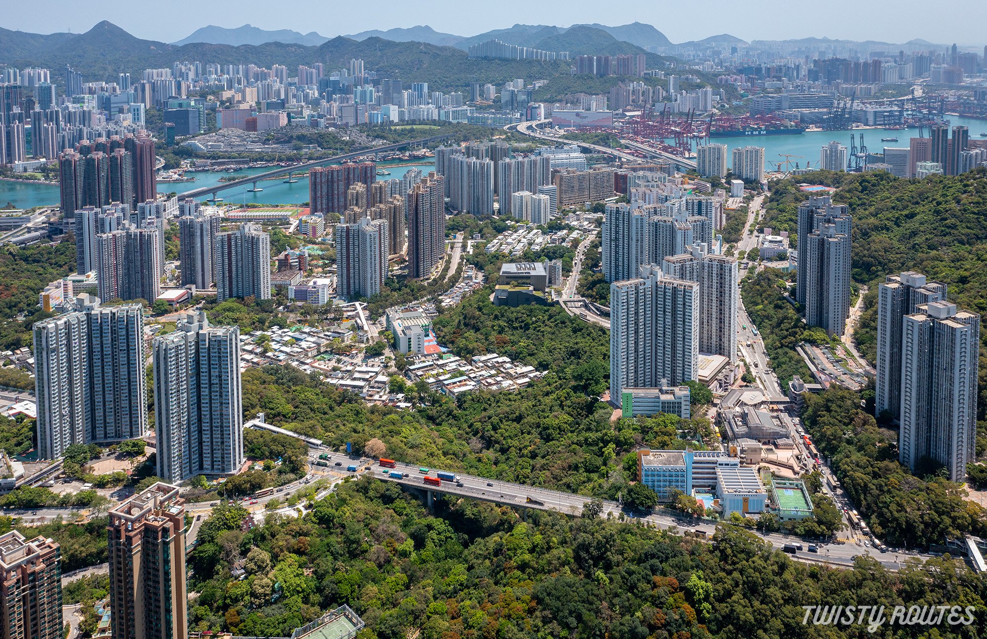
Hong Kong has more to offer than tall skyscrapers and magnificent infrastructure. Peeping through this concrete jungle, you will always find a short trail to explore just a stone’s throw away from your home. Hong Kong has over 579 named peaks in the city and is known as one of the best urban hiking places in the world.
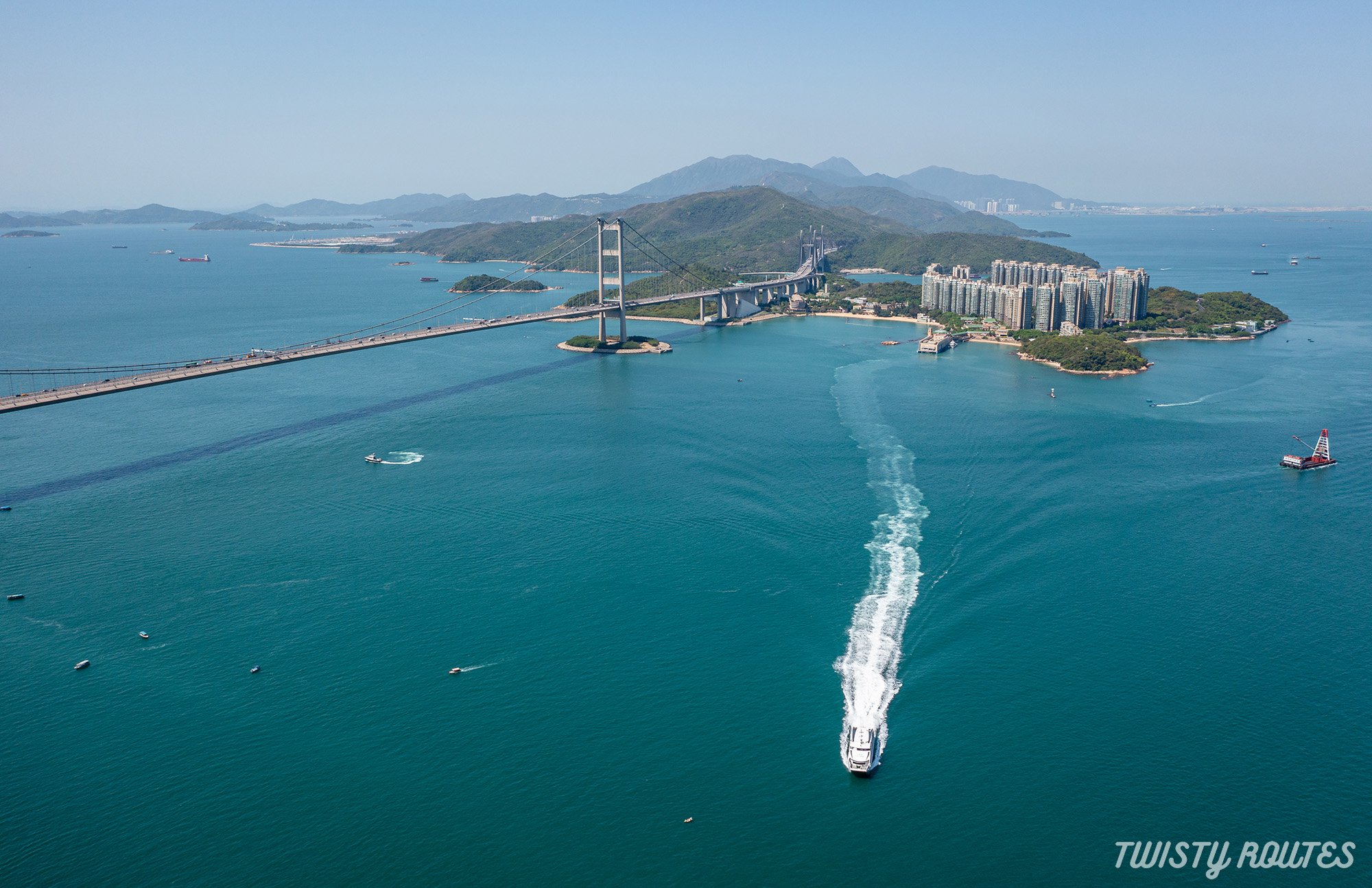
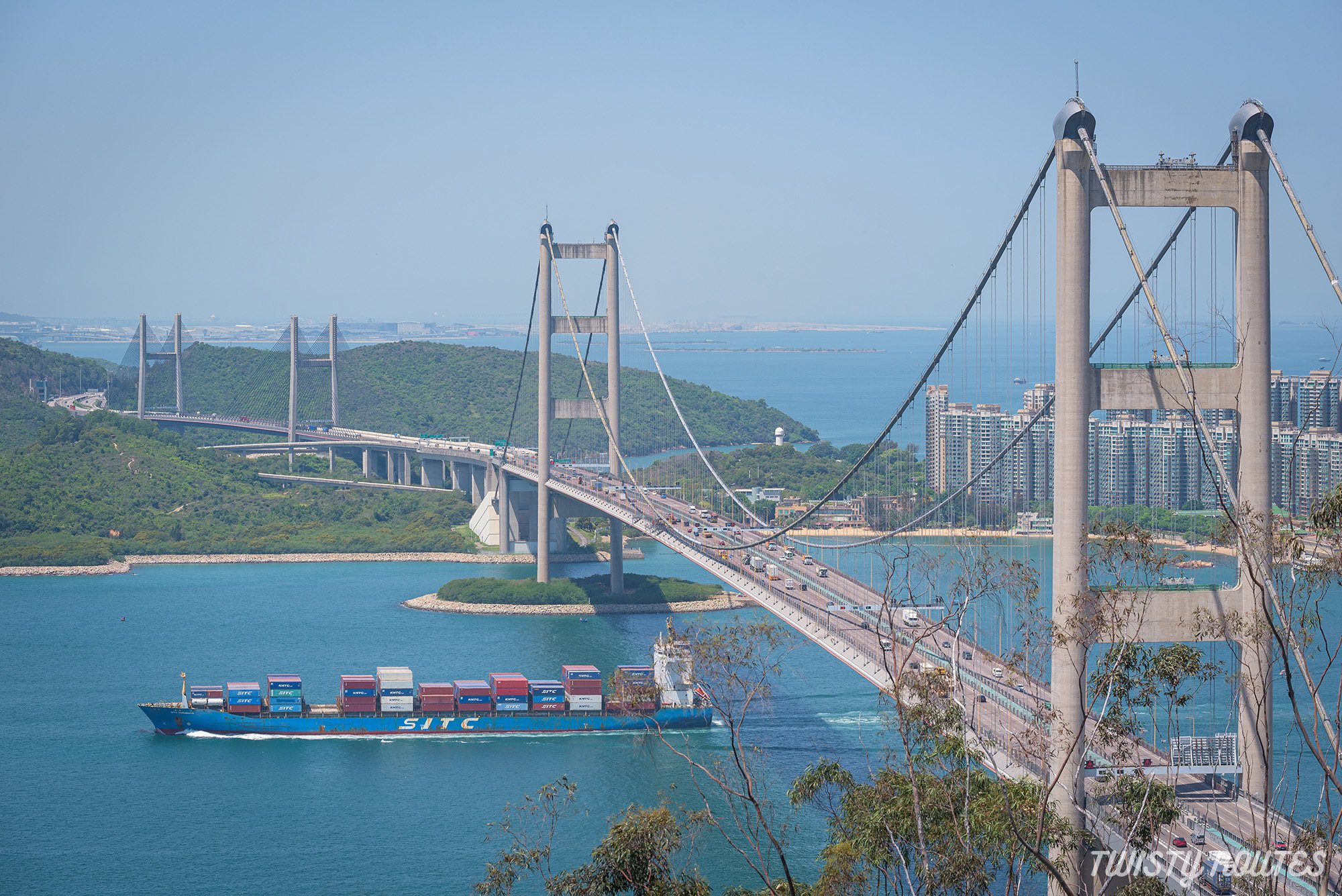
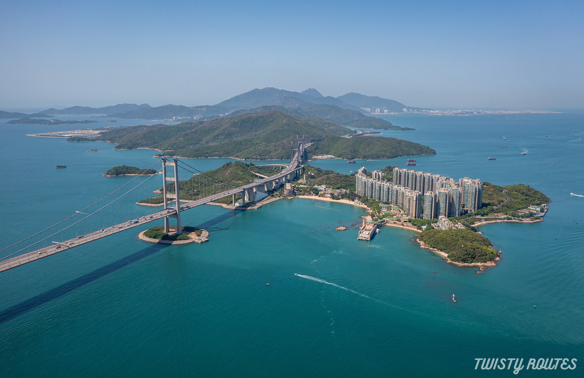
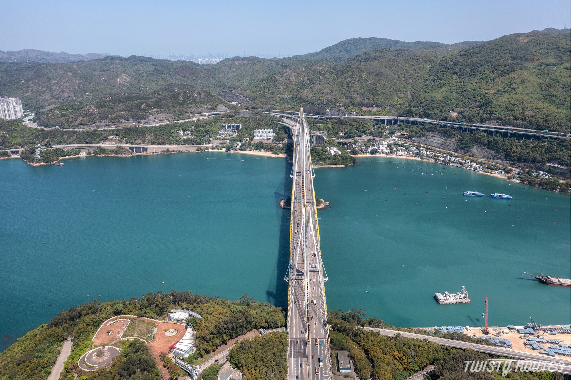
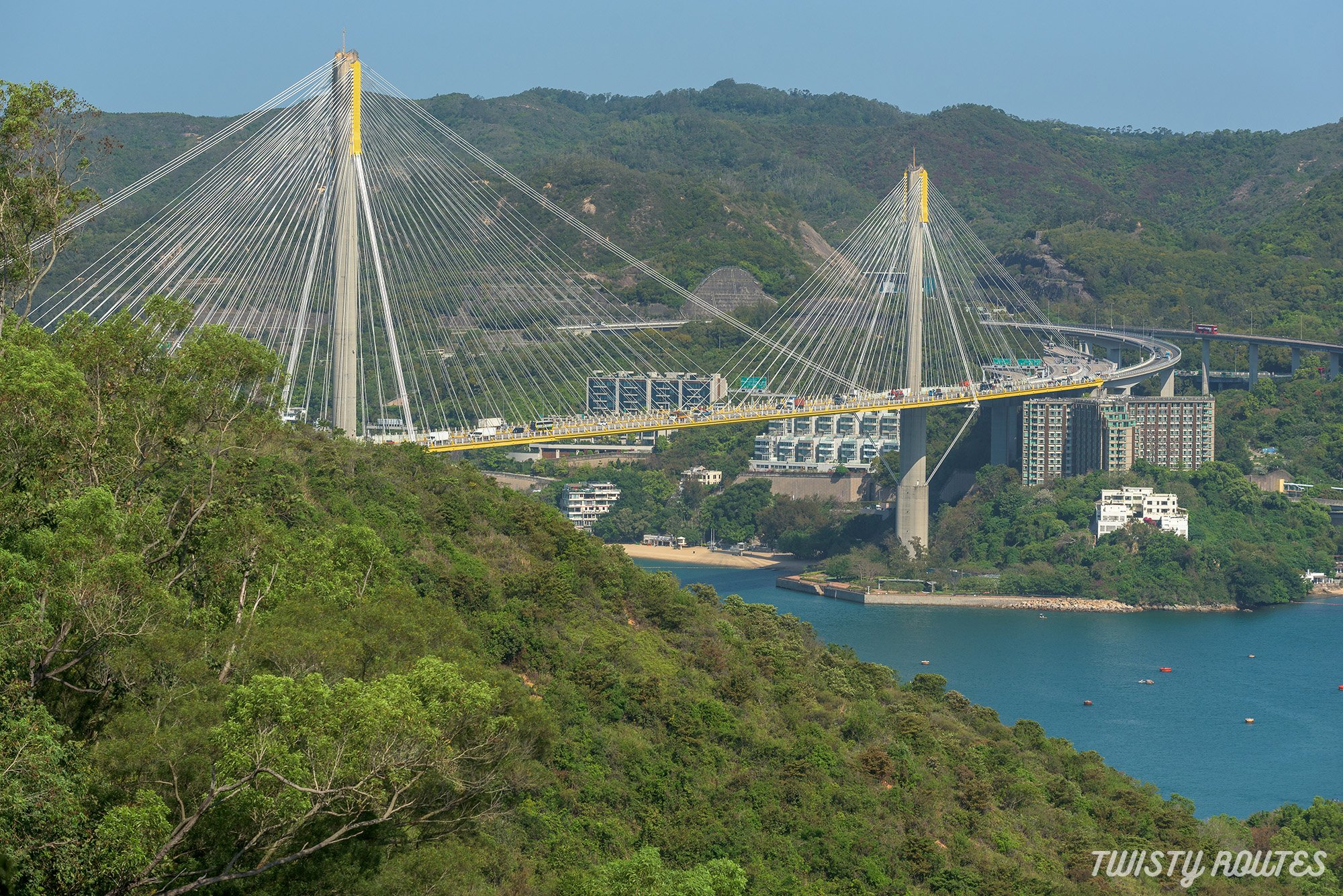
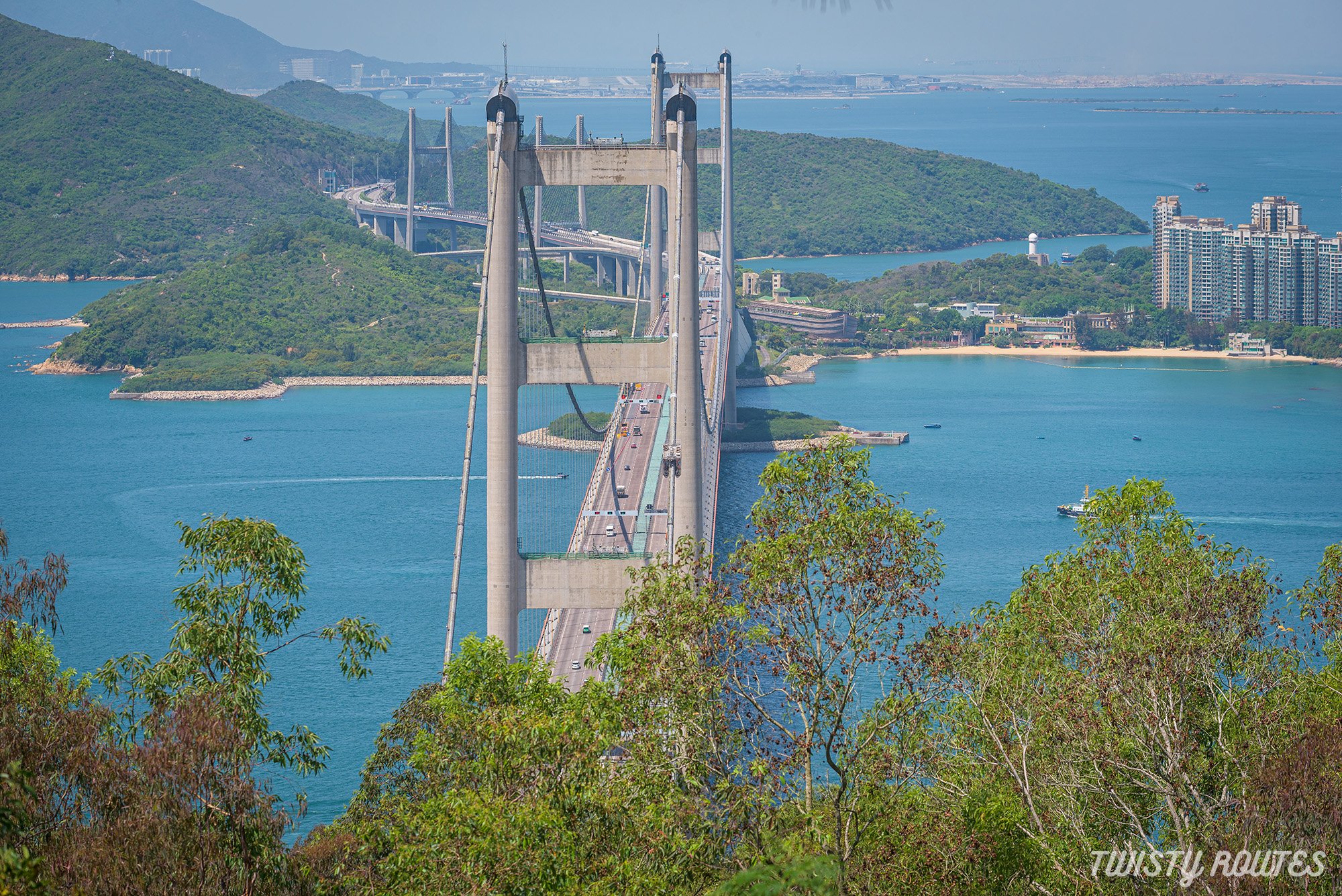
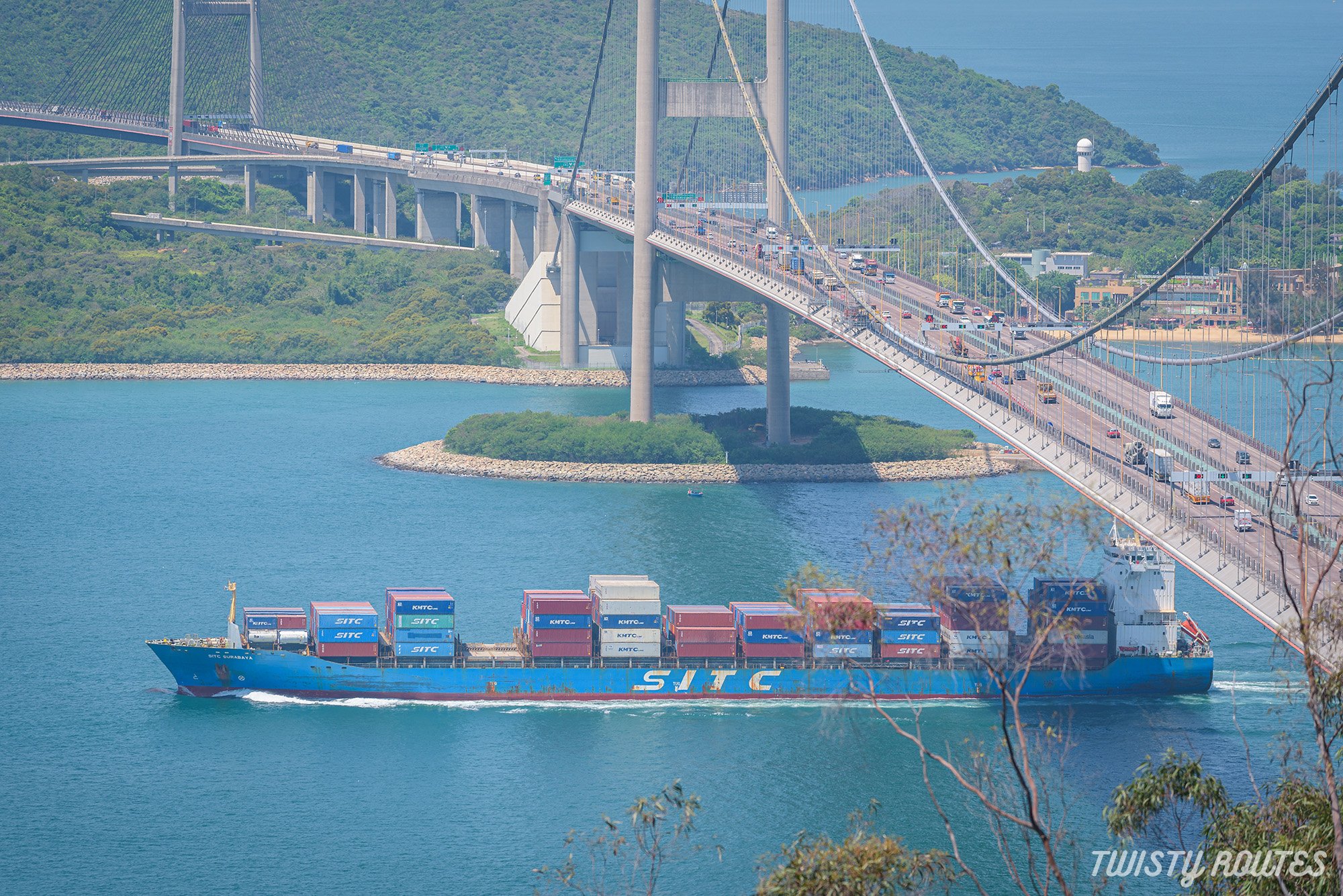
Today, we hiked the Tsing Yi Nature Trails that start at Tsing Yi Island, New Territories, Hong Kong. The hiking trails were commenced in 1997 and completed in 1998. This easy hike provides uninterrupted views of the magnificent Tsing Ma Bridge, Ting Kau Bridge, Rambler Channel, and Hong Kong's longest road - The Castle Peak Road.
On a clear day, you can also view the Hong Kong International Airport at a distance, as this hill sits beneath the flight path to the airport, making it a good place for plane spotting.
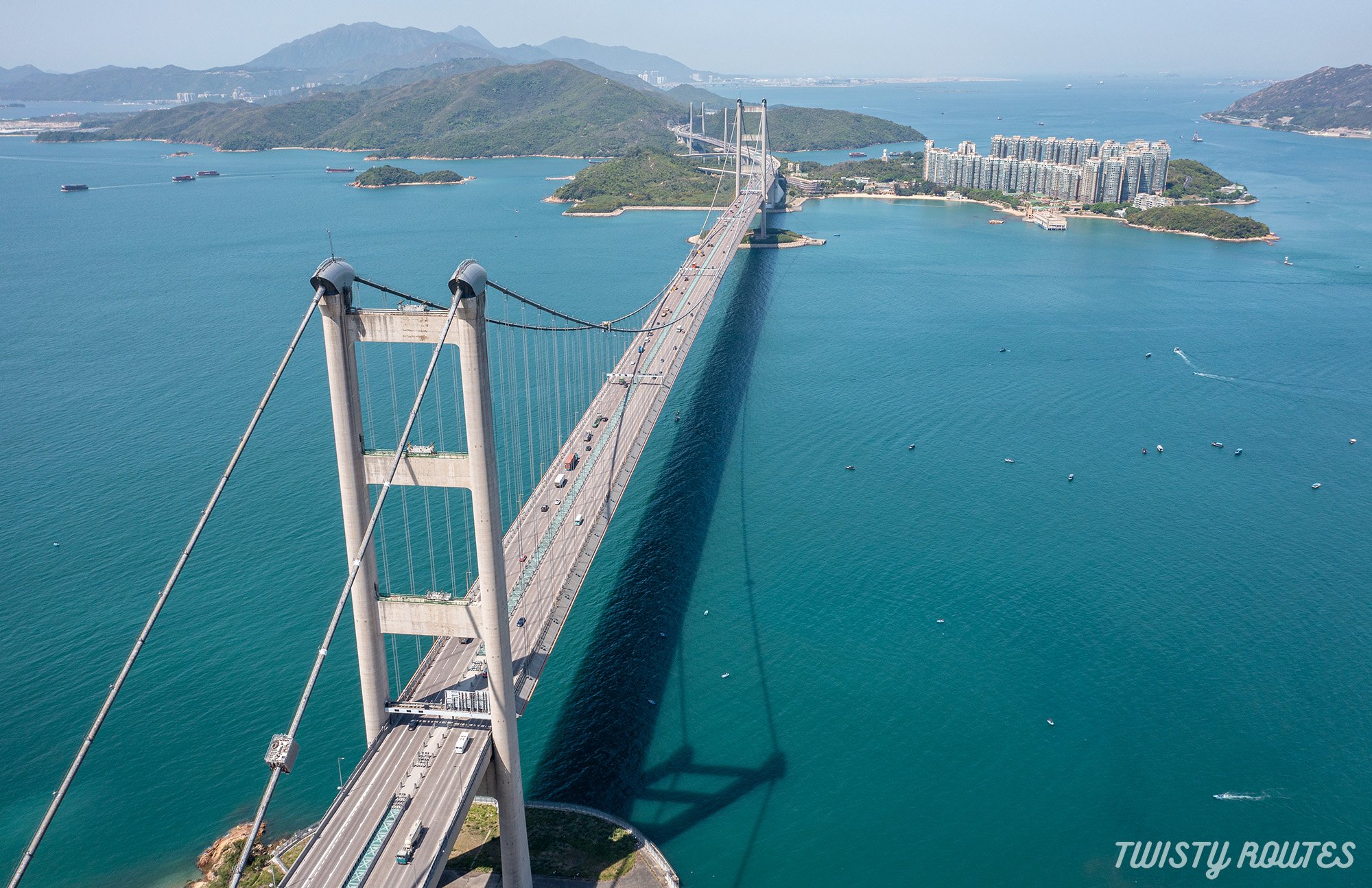
Aerial shot of Tsing Ma Bridge
|
Elevation 142 meters |
Distance 4.5 kilometers |
Time Taken 90 -120 mins |
Difficulty Rating Easy |
Highlights of the hike
The best viewpoints of the Tsing Ma Bridge, Ting Kau Bridge, Rambler Channel & Castle Peak Road
Mostly shaded hike
Family friendly hike
Here is a short video of this hike
Getting Here
Arrive at MTR Tsing Yi by taking the Tung Chung Line and getting off at Tsing Yi station.
From MTR Tsing Yi Station Exit A1, take bus 248M to the last stop at Cheung Wang Estate. You can also take green minibuses 409, 409S, and 409K from Tsing Yi MTR. Alight the bus and walk up Liu To Road, pass the green minibuses and walk until the end of the road to find the north entrance of the Tsing Yi Nature Trails on the right.
This is your starting point.
This is a very popular hike among all age groups and you will always see locals and expats on this hike. If you are up for walking up and down the hill, this is a perfect hike.
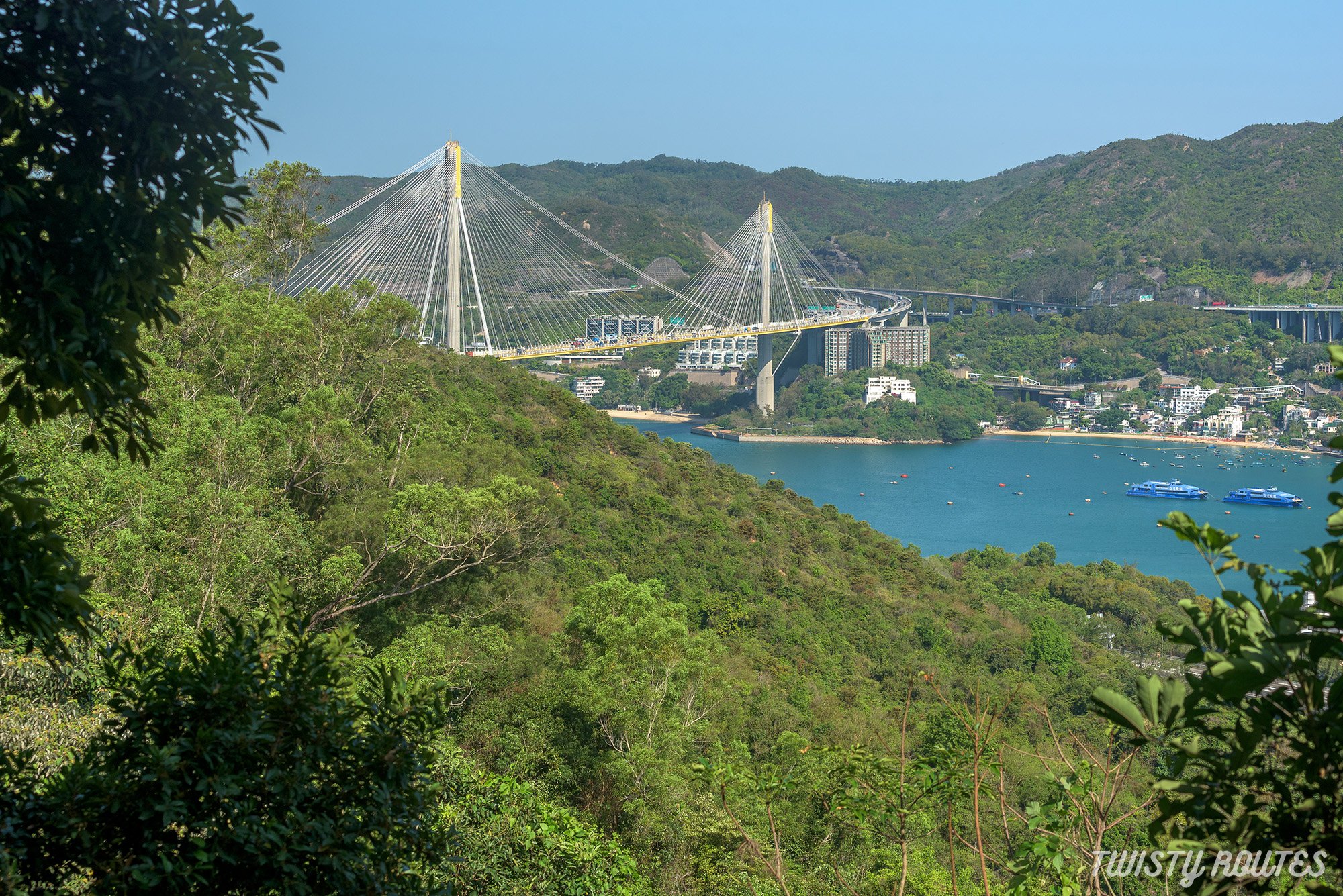
You will start your hike with zigzag flights of stairs taking you up to a flat path. Walk for a few minutes on this flat path and on your right you will get your first glimpse of the Ting Kau Bridge peeping through the trees at a distance.
There are recreational facilities such as picnic areas, Chinese-style pavilions, sit out areas, fitness equipments and benches along the way, making it an ideal trail for hiking and family outings. As this is mostly a shaded hike passing through the forest, you can hear the sounds of nature, so drop your airpods and listen to the ‘sound of music’ in the mountains.

Benches along the way
Keep right, follow the zigzagged flat path until you arrive at a pavilion. Here, you will see a path towards the Kwai Tsing Celebration of Reunification Education Trail, it leads back out to Liu To Road. Don’t take this path and stick to your right, continue on Ching Hom Path.

Ching Hom Path
This section is mostly a shaded path with a few gentle slopes, and there's even a wooden railing to keep the little ones safe from getting too close to the edge!
You will soon arrive at your next junction, take the stairs downhill, and follow the sign for Pavilion 3 that takes you deeper into the forest, again flat path with a few gradual inclines. Before you get too comfortable, there is a long flight of stairs just before reaching the pavilion.
Pavilion 3 is the highest point of the hike.
During the hike, we saw a few locals playing jianzi, listening to songs, practicing tai chi, and exercising in the open gym - it reminds us to stay happy and healthy.
From this pavilion, follow the sign towards Ching Hom Path. In a few minutes of walking and stair-climbing, you will reach a gorgeous viewing point, where your efforts are rewarded with the magnificent view of Tsing Ma Bridge.
On your left will be a concrete jungle of high-rise buildings, and on your right will be the Tsing Ma Bridge and Ma Wan.

From here, take the stairs downhill towards Picnic Area 1 (approximately 10 mins, 300m). This trail has signboards and maps at every junction, so there is minimal chance of getting lost.
From the picnic area, keep walking towards Ching Wan Path.
Take another flight of stairs and walk along the unshaded section of the hike. Soon you will arrive at another junction, follow the sign for the South Entrance roughly 15 minutes from here. And now mostly it is flat with gradual incline or downhill, no more long flight of stairs.
After 5 minutes, you will arrive at another panoramic viewpoint from where you can get a closer look at the high-rise buildings of Tsing Yi and Rambler Channel.

Panoramic Viewpoint while heading to the South Entrance
Continue walking downhill, and you will eventually hear the sound of the traffic and reach the South entrance arch at Tsing Yi West Road. From here, take a left to the bus stop near the footbridge, where you will find a few buses taking to back to the city or Tsing Yi MTR station.
We hope you found this guide useful. Don't forget to follow us on Instagram (@twisty.routes) and subscribe to our Youtube Channel for more such adventures. You can share this with your friends and family, and let us know how your hike was in the comments.

The South Entrance - end of our hike
Useful tips
It is a shaded hike, walking through the forest except for the last leg towards the south entrance.
If hiking during the summer months carry your caps, umbrellas, and sunscreen.
You can start this hike from multiple paths, so follow the above instructions if you want to do our suggested route
Do this hike early on in the day so you can get clear views or towards the evening while the sun is just setting behind Tsing Ma bridge
Carry a bug spray as you will be hiking through the paved forest mostly
Photo Gallery